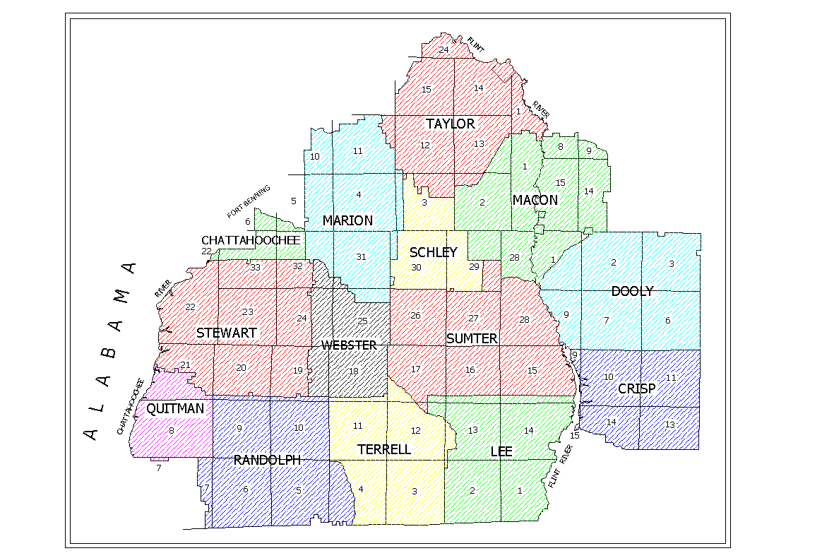
Littlefield & Associates Land Lot Map Index
My father is a Professional Land Surveyor and Professional Engineer in Georgia. He created Land Lot Maps for the counties shown below after much research in the late 1960's and early 1970's. He has allowed these maps to be published here with the understanding that the maps are not for commercial use. The maps are presented only for the use of genealogists, historians, etc., and definitely not for presentation on other web sites. Please honor his request. You are welcome to link to my home page but I wouldn't recommend linking to this page as it will most likely be reorganized. Click on the appropriate county for the Land Lot Map. Then click on the thumbnail image for the Land District. Use your browser's back arrow to move back. The full images are large and can take up to a minute or so to download on dial-up connections. |
![]()